- Sleeping Giant Provincial Park
Infobox Protected area
name = Sleeping Giant Provincial Park
iucn_category = II
caption =
base_width = 288
locator_x = 79
locator_y = 159
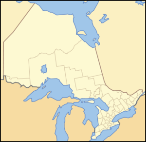
location = Thunder Bay District,Ontario
nearest_city = Thunder Bay,Ontario ,Canada
lat_degrees=48 |lat_minutes=20 |lat_seconds=14 |lat_direction=N
long_degrees=88 |long_minutes=54 |long_seconds=16 |long_direction=W
area = convert|243.91|km2|acre|abbr=on ["Sleeping Giant Background Information", 2.0 Background Information, Overview, pp. 4.]
established = 1944 as Sibley Provincial Park
visitation_num =
visitation_year =
governing_body =Ontario Parks Sleeping Giant Provincial Park, established in 1944 as Sibley Provincial Park and renamed in 1988, is a convert|244|km2|sqmi|0 park located on the
Sibley Peninsula inNorthwestern Ontario , east of Thunder Bay. The nearest communities are Pass Lake, located at the northern entrance to the park, and Dorion, located convert|35|km|mi|0 NW, both in the township of Shuniah. The seasonal community of Silver Islet is located on the southern tip of the peninsula. The primary feature of the park is the Sleeping Giant, which is most visible from the city of Thunder Bay.The park occupies most of the lower portion of the peninsula excluding the area around the seasonal community of Silver Islet, and a portion of Thunder Cape which is designated as the Thunder Cape Bird Observatory. ["Sleeping Giant Background Information", 2.0 Background Information, Figure 2 - Adjacent Land Use, pp. 6.] The eastern portion of the park is lowlands, while the western half is terrain composed of cliffs, valleys, and the
mesa –cuesta s which make up the Sleeping Giant formation. At its eastern edge, it will touch the futureLake Superior National Marine Conservation Area .Geography
The Sibley Peninsula is convert|52|km|mi|0 long and convert|10|km|mi|0 wide. It projects into Lake Superior from the north shore, separating Thunder Bay to the west and Black Bay to the east. The peninsula can be separated into two physiographic areas—highlands and
lowland s. The highlands dominate the western half of the peninsula, and rise to convert|380|m|ft|0 above the surface of Lake Superior. The lowlands of the eastern portion of the peninsula rise to only convert|75|m|ft|0, over an area 3 to 6 kilometres (2 to 4 mi) wide. With the exception ofdiabase dikes and the large diabase sill that forms the upper portion of the Sleeping Giant, the peninsula is underlain bysedimentary rocks , which strike northeast and slope towards the southwest, forming acuesta . ["Sleeping Giant Background Information", 3.2 Earth Science, Topography, pp. 11.]Ecology
The varied terrain and the effect of Lake Superior on the peninsula's microclimates provide
habitat s for a wide variety of plants and animals.Plants found in the park include 23 species of
orchid s including Bog Adder's-mouth (Malaxis paludosa) and Small Round-leafed Orchis (Amerorchis Rotundifolia), two of Ontario's rarest species, as well as 22 species of alpine arctic disjuncts. ["Sleeping Giant Background Information", 3.3 Life Science, Significant Plant Communities, pps. 22–23.]Wildlife found in the park includes wide variety of mammals, the most dominant species being
white tailed deer , black bears, andmoose . Close to 200 species of birds have been recorded at the park, and about 75 species are known to nest in the park. The park is also home to a few species of amphibians and reptiles, and many species of fish. ["Sleeping Giant Background Information", 3.3 Life Science, Wildlife, pps. 24–26.]Activities
Sleeping Giant Provincial Park offers numerous recreational activities. The park has more than convert|100|km|mi|0 of trails, the longest being the convert|40|km|mi|0 Kabeyun Trail. [ [http://www.ontarioparks.com/english/slee-hiking.html Sleeping Giant - Hiking] . The sum length of all trails is convert|103.1|km|mi|1. Retrieved on 26 September 2007.] Summer programs include guided nature walks and group
campfire s, and films at the parkamphitheater . Other activities include boating,fishing , andcycling . The park grooms convert|50|km|mi|0 ofcross-country ski trails in the winter.Facilities
The park has several
camp ground s more than 240 camp sites. The main camp ground is at Marie Louise Lake, which has 200 camp sites, 85 of which are electric. [ [http://www.ontarioparks.com/english/slee-facilities.html# Sleeping Giant - Facilities and Services] . Retrieved on 26 September 2007.] An additional 40 camp sites are located through the park along it's interior trails. [ [http://www.ontarioparks.com/english/slee-multiple.html Sleeping Giant - Park Activities] . Retrieved on 26 September 2007.] The park has apicnic area andbeach , and boat ramps, as well as indoor washroom and shower facilities and alaundromat .Canoe s andkayak s can be rented from the park store.Natural Heritage Education
Sleeping Giant Provincial Park is part of the
Natural Heritage Education program. Primary interpretive themes include the Sleeping Giant formation; the geology of the park and surrounding areas; thelegend about the Sleeping Giant; the transitional forest; botanical disjuncts and rarities; the history ofSilver Islet ;Paleo-Indian occupation of the area and subsequent pre-historic cultures; and wildlife viewing. The program is administered from the visitors centre at the Marie Louise Lake campground. ["Sleeping Giant Background Information", 4.0 Inventory and Evaluation of Cultural Resources, interpretive Assessment and Themes, pp. 27.]See also
*
Sibley Peninsula
*Silver Islet
*Sleeping GiantReferences
*Ontario Parks " [http://www.ontarioparks.com/English/planning_pdf/sleeping_giant_bg_info.pdf Sleeping Giant Background Information] " (2003) Queen's Printer for Ontario. ISBN 0-7794-3989-2. Retrieved on 26 September 2007.
External links
* [http://www.ontarioparks.com/english/slee.html Sleeping Giant Provincial Park]
* [http://www.visitthunderbay.com/sleeping_giant/index.htm Visit Thunder Bay - The Sleeping Giant]
* [http://www.thefriendsofsleepinggiant.ca The Friends of the Sleeping Giant]
* [http://www.firstpeople.us/FP-Html-Legends/TheSleepingGiant-Ojibwa.html Firstpeople.us - The legend of the Sleeping Giant]

Wikimedia Foundation. 2010.