- Nógrád County (former)
-
Comitatus Neogradiensis
Nógrád CountyCounty of the Kingdom of Hungary 12th century–1920 
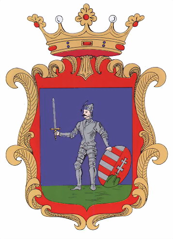
Coat of arms
Capital Balassagyarmat History - Established 12th century - Treaty of Trianon June 4 1920 Area - 1910 4,128 km2 (1,594 sq mi) Population - 1910 261,500 Density 63.3 /km2 (164.1 /sq mi) Today part of Slovakia, Hungary
Nógrád (Hungarian; Latin: comitatus Neogradiensis, German: Neuburg or Neograd, Slovak: Novohrad) was the name of a historic administrative county (comitatus) of the Kingdom of Hungary. Its territory is presently in southern Slovakia and in northern present-day Hungary. The name Novohrad is still used in Slovakia as an informal designation of the corresponding territory. The name stems from the former Nógrád (Novohrad) castle in present-day Hungary.Contents
Geography
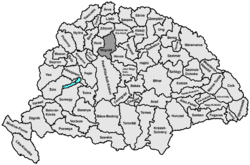
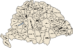
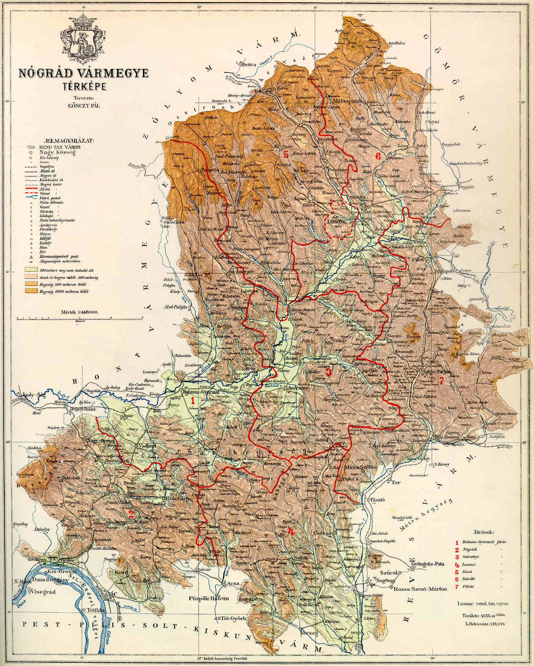
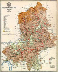 Map of Nógrád county
In 1910, Nógrád county shared borders with the counties Hont, Zólyom (Zvolen), Gömör-Kishont (Gemer-Malohont), Heves and Pest-Pilis-Solt-Kiskun. It was situated approximately along the line Poltár, Losonc (today Lučenec), Szécsény and Vác. The river Ipeľ/Ipoly flowed through the county. Its area was 4,133 km² around 1910.
Capitals
The capital of the county was Balassagyarmat, except for the 18th century, when the capital was Lučenec.
History
Nógrád was one of the first counties of the Kingdom of Hungary, founded in the 11th century. It was ruled by the Ottoman Empire from 1541 to 1595, and from 1605 to 1686, as part of Budin Province and Egri Province.
In the aftermath of World War I, the part of Nógrád county north of the river Ipeľ/Ipoly became part of newly formed Czechoslovakia (as Novohrad county), as recognized by the concerned states in the 1920 Treaty of Trianon. The southern part stayed in Hungary. Following the provisions of the controversial First Vienna Award, the northern half of Novohrad came under Hungarian control in November 1938. After World War II, the Trianon borders were restored. In 1993, Czechoslovakia dissolved and Novohrad became part of independent Slovakia. Since 1996, it is part of the Slovak administrative unit Banska Bystrica region.
The Hungarian part of Nógrád merged with the Hungarian part of Hont county to form Nógrád-Hont county. Between 1939 and 1945 it was united with the occupied half of the Slovak part of Nógrád county. Since 1950, the Hungarian part of Nógrád, with a small part of former Hont county added, forms the present Hungarian county Nógrád.
Subdivisions
In the early 20th century, the subdivisions of Nógrád/Novohrad county were:
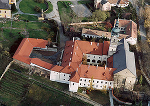 Franciscan Convent Szécsény - Aerial Photo
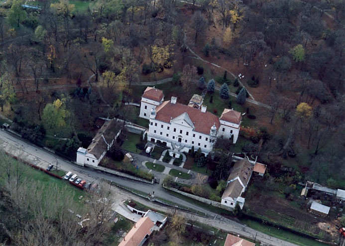
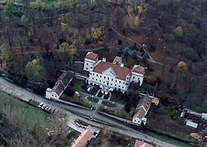 Szirák - Palace from above
Districts (járás) District Capital Balassagyarmat Balassagyarmat Gács Gács, SK Halič Losonc Losonc, SK Lučenec Nógrád Rétság Salgótarján Salgótarján Szécsény Szécsény Szirák Szirák Urban districts (rendezett tanácsú város) Losonc, SK Lučenec The towns of Lučenec and Halič are presently in Slovakia.
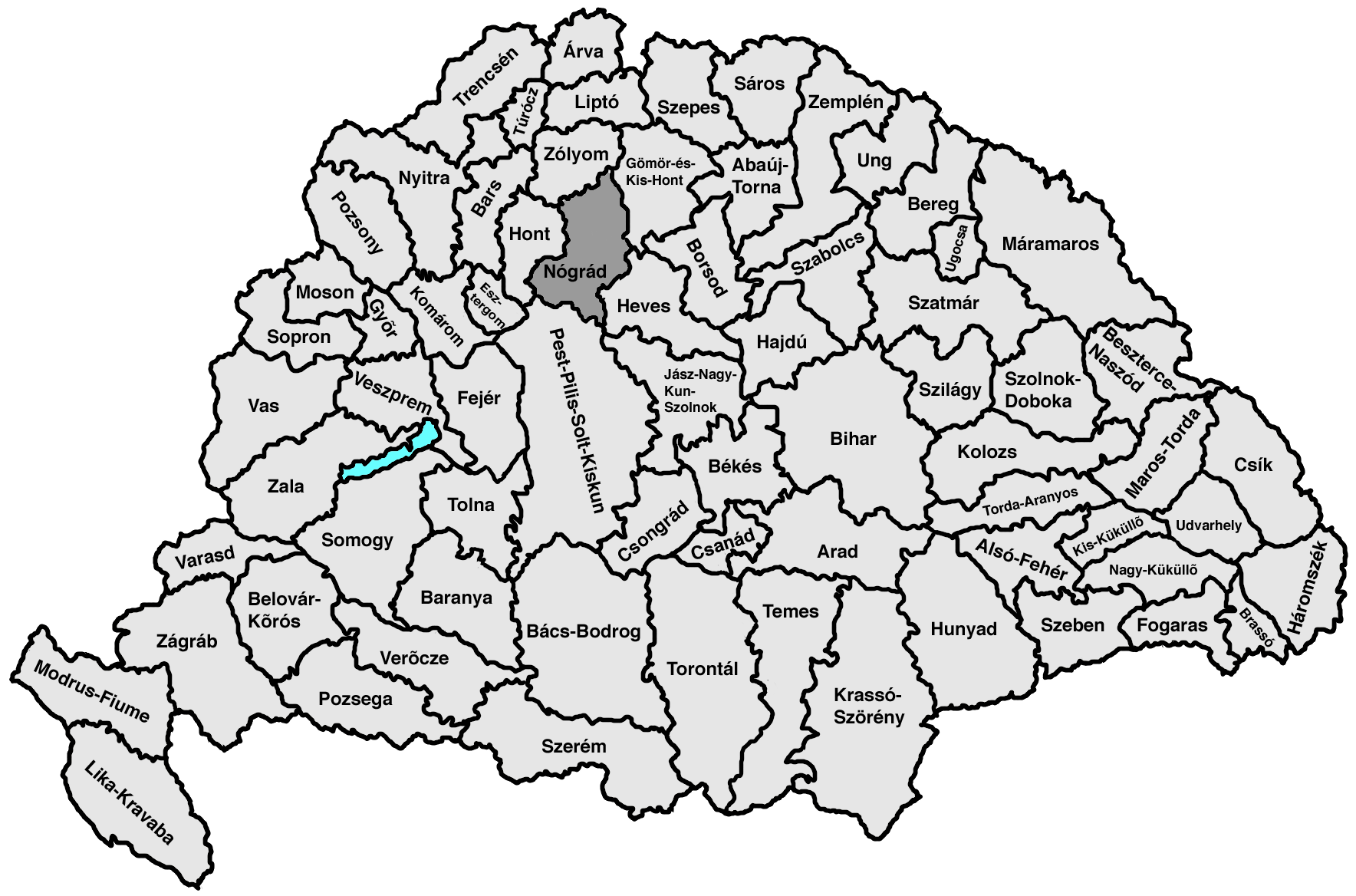
Counties of the Kingdom of Hungary (1886) Abaúj-Torna · Alsó-Fehér · Arad · Árva · Bács-Bodrog · Baranya · Bars · Békés · Bereg · Beszterce-Naszód · Bihar · Borsod · Brassó · Csanád · Csík · Csongrád · Esztergom · Fejér · Fogaras · Gömör-Kishont · Győr · Hajdú · Háromszék · Heves · Hont · Hunyad · Jász-Nagykun-Szolnok · Kis-Küküllő · Kolozs · Komárom · Krassó-Szörény · Liptó · Máramaros · Maros-Torda · Moson · Nagy-Küküllő · Nógrád · Nyitra · Pest-Pilis-Solt-Kiskun · Pozsony · Sáros · Somogy · Sopron · Szabolcs · Szatmár · Szeben · Szepes · Szilágy · Szolnok-Doboka · Temes · Tolna · Torda-Aranyos · Torontál · Trencsén · Turóc · Udvarhely · Ugocsa · Ung · Vas · Veszprém · Zala · Zemplén · Zólyom
Corpus separatum: Fiume
Autonomous Kingdom of Croatia-Slavonia: Bjelovar-Križevci · Lika-Krbava · Modruš-Rijeka · Požega · Srijem · Varaždin · Virovitica · Zagreb
 Categories:
- 1920 disestablishments
- Counties in the Kingdom of Hungary
- States and territories established in the 12th century


Wikimedia Foundation. 2010.