- Croft, Cheshire
-
Coordinates: 53°26′13″N 2°33′09″W / 53.43700°N 2.55240°W
Croft 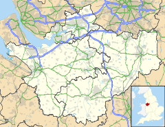
 Croft
Croft
Croft shown within CheshirePopulation 2,920 (2001 Census)[1] OS grid reference SJ634935 Parish Croft Unitary authority Warrington Ceremonial county Cheshire Region North West Country England Sovereign state United Kingdom Post town WARRINGTON Postcode district WA2, WA3 Dialling code 01925 Police Cheshire Fire Cheshire Ambulance North West EU Parliament North West England UK Parliament Warrington North List of places: UK • England • Cheshire Croft is a village and civil parish in Warrington, Cheshire, England, about five miles north of Warrington town centre. According to the 2001 Census it had a population of 2,920.[1] It is a rural, residential district.
The village is on the northern edge of the borough of Warrington, north of the interchange of the M6 and M62 motorways (known as the Croft Interchange). It is situated close to the border with Merseyside and Greater Manchester, and was historically in Lancashire. In terms of the local area, it borders Culcheth to the east, Lowton (which is in Greater Manchester) to the north, Winwick to the west and Risley to the south.
In Croft there are two churches, two primary schools, and a large playing field with children's play equipment area (the village green). Other facilities include a youth centre, horse riding, a golf range, a bowling green and a hairdresser. There was no village shop for a while, however one has been opened up next to the general elliot pub.
In terms of transport, the service 19 bus serves the main part of Croft as part of the route between Leigh (via Culcheth) and Warrington (via Winwick). There is also a rural service to Birchwood.
At the 2001 Census, Croft had the following demographics:[2]
- 871 households
- 2,920 residents
- 61.7% are male
- 38.3% are female
- Average age of residents: 40.26 years (mean)
- 2,014 residents describe their health as good
References
- ^ a b "2001 Census: Croft". Office for National Statistics. http://neighbourhood.statistics.gov.uk/dissemination/LeadTableView.do?a=3&b=790887&c=croft&d=16&e=15&g=388146&i=1001x1003x1004&m=0&r=1&s=1223123554312&enc=1&dsFamilyId=779. Retrieved 4 October 2008.
- ^ "2001 Census, Key Statistics: Croft". Office for National Statistics. http://neighbourhood.statistics.gov.uk/dissemination/LeadDatasetList.do?a=3&b=790887&c=croft&d=16&g=388146&i=1001x1003&m=0&r=1&s=1223124284625&enc=1&domainId=15. Retrieved 4 October 2008.
External links
 Media related to Croft, Cheshire at Wikimedia Commons
The Borough of Warrington, Cheshire Principal Settlements Civil Parishes Appleton • Birchwood • Burtonwood and Westbrook • Croft • Cuerdley • Culcheth and Glazebury • Grappenhall and Thelwall • Great Sankey • Hatton • Lymm • Penketh • Poulton-with-Fearnhead • Rixton-with-Glazebrook • Stockton Heath • Stretton • Walton • Winwick • WoolstonUnparished Areas Ceremonial county of Cheshire Unitary authorities Major settlements Rivers Topics - History
- Museums
Categories:- Warrington
- Villages in Cheshire
- Civil parishes in Warrington
- Cheshire geography stubs

Wikimedia Foundation. 2010.