- Osterfeld
-
Osterfeld 
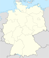
 OsterfeldLocation of the town of Osterfeld within Burgenlandkreis district

Coordinates 51°4′36″N 11°55′59″E / 51.07667°N 11.93306°ECoordinates: 51°4′36″N 11°55′59″E / 51.07667°N 11.93306°E Administration Country Germany State Saxony-Anhalt District Burgenlandkreis Municipal assoc. Wethautal Mayor Gerd Seidel (SPD) Basic statistics Area 27.61 km2 (10.66 sq mi) Elevation 250 m (820 ft) Population 2,654 (31 December 2010)[1] - Density 96 /km2 (249 /sq mi) Other information Time zone CET/CEST (UTC+1/+2) Licence plate BLK Postal codes 06721, 06722 Area code 034422 Website www.vgem-wethautal.de Osterfeld is a town in the Burgenlandkreis district, in Saxony-Anhalt, Germany. It is situated southeast of Naumburg. It is part of the Verbandsgemeinde ("collective municipality") Wethautal.
Towns and municipalities in the district of Burgenlandkreis An der Poststraße | Bad Bibra | Balgstädt | Droyßig | Eckartsberga | Elsteraue | Finne | Finneland | Freyburg | Gleina | Goseck | Gutenborn | Hohenmölsen | Kaiserpfalz | Karsdorf | Kretzschau | Lanitz-Hassel-Tal | Laucha an der Unstrut | Lützen | Meineweh | Mertendorf | Molauer Land | Naumburg | Nebra | Osterfeld | Schnaudertal | Schönburg (Saale) | Stößen | Teuchern | Weißenfels | Wethau | Wetterzeube | Zeitz
References
- ^ "Bevölkerung der Gemeinden nach Landkreisen" (in German). Statistisches Landesamt Sachsen-Anhalt. 31 December 2010. http://www.statistik.sachsen-anhalt.de/download/stat_berichte/6A102_hj_2010_02.pdf.
Categories:- Towns in Saxony-Anhalt
- Burgenlandkreis
- Burgenlandkreis geography stubs


Wikimedia Foundation. 2010.