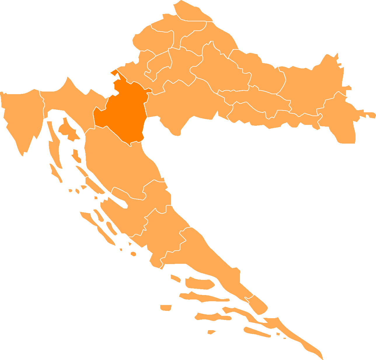
- Karlovac County
Croatian County
name =Karlovačka Županija
image_coat_of_arms =Karlovac county.gif
image_coat_of_arms_size =100px
Coat_of_arms_
image_flag_size =200px
Flag_
capital =Karlovac
area =3.622 km²
population =141,787
date-population =2001
density =39.14/km²
latd =
latm =
longd =
longm =
code =047
iso =HR-04
zupan =Ivica Horvat (HDZ)
site =http://www.kazup.hr/
notes =Karlovac county - "Karlovačka županija" is a
county in centralCroatia , with the administrative center inKarlovac .The city of
Karlovac is another fort from the times of theMilitary Frontier . It was built as a six-side star fort in the 16th century at the point of confluence of four rivers.The town blossomed in the 18th and the 19th century after being made a free town, with the development of roads between
Pannonian plain s to the seaside, and waterways along the Kupa river. The 20th century wasn't so favourably inclined, but the city's recovering, once again making use of its crucial geostrategic point inCroatia .The county itself extends towards the north to the water springs of
Jamnica , and towards the south all the way down to the mountainous regions ofGorski kotar andLika , in particular to theBjelolasica mountain which features the largest winter sport recreation center in the country.Geography
The County of Karlovac is situated in the central part of Croatian state territory and covers an area of approximately 3.622 km² which makes this county one of the largest among 20 counties existing in
Croatia . Because of its transit, traffic and geostrategic position, the County of Karlovac is one of the most important in the whole country.Karlovac County is an intersection and major junction of the most important roads between
Europe and the Adriatic coast. Karlovac County borders with theRepublic of Slovenia and the Republic ofBosnia and Herzegovina , and is also contiguous with four other counties: the County of Zagreb,Sisak-Moslavina County ,Primorje-Gorski Kotar County and the County of Lika-Senj.Demographics
As of the
census of 2001, there are 141,787 people and 49,621 households residing in county. Thepopulation density is 39/km². The ethnic make up of the county is 84,27% Croatian, 11,04% Serbian.In the county the population is spread out with 20.7% under the age of 19, 52,0% from 19 to 60 and 27,3% older than 60.
Administrative division
Karlovac county is divided:
* City of
Karlovac
* Town ofDuga Resa
* Town ofOgulin
* Town ofOzalj
* Town ofSlunj
* Municipality ofBarilović
* Municipality ofBosiljevo
* Municipality ofCetingrad
* Municipality ofDraganić
* Municipality ofGeneralski Stol
* Municipality ofJosipdol
* Municipality ofKrnjak
* Municipality ofLasinja
* Municipality ofNetretić
* Municipality ofPlaški
* Municipality of Rakovica
* Municipality of Ribnik
* Municipality ofSaborsko
* Municipality ofTounj
* Municipality ofVojnić
* Municipality ofŽakanje County government
Current Župan (prefect):
Ivica Horvat (HDZ)The county assembly is composed of 44 representatives, organized as follows:
*
Croatian Democratic Union (HDZ) 16
*Social Democratic Party of Croatia (SDP) 11
*Croatian Peasants Party (HSS) 6
*Croatian Social Liberal Party (HSLS) 4
*Democratic Centre (DC) 3
*Croatian Party of Rights (HSP) 1
*Croatian Pure Party of Rights (HČSP) 1
*Croatian Bloc (HB) 1
* independent representative 1External links
* [http://www.kazup.hr/ Karlovac County] hr icon
* [http://www.karlovac.hr/ Karlovac] hr icon
* [http://www.bjelolasica.hr/ Bjelolasica]
Wikimedia Foundation. 2010.