- Wienerwald
Geobox | Range
name=Wienerwald
other_name=Vienna Woods
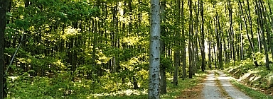
image_caption=Vienna Woods near Breitenfurt
country=Austria
region_type=States
region=Lower Austria| region1=Vienna
parent=Northern Limestone Alps
length_imperial=| length_orientation=
width_imperial= | width_orientation=
geology= | period= | orogeny=
highest=Schöpfl
highest_elevation=893
highest_lat_d=48|highest_lat_m=5|highest_lat_s=14|highest_lat_NS=N
highest_long_d=15|highest_long_m=54|highest_long_s=43|highest_long_EW=E
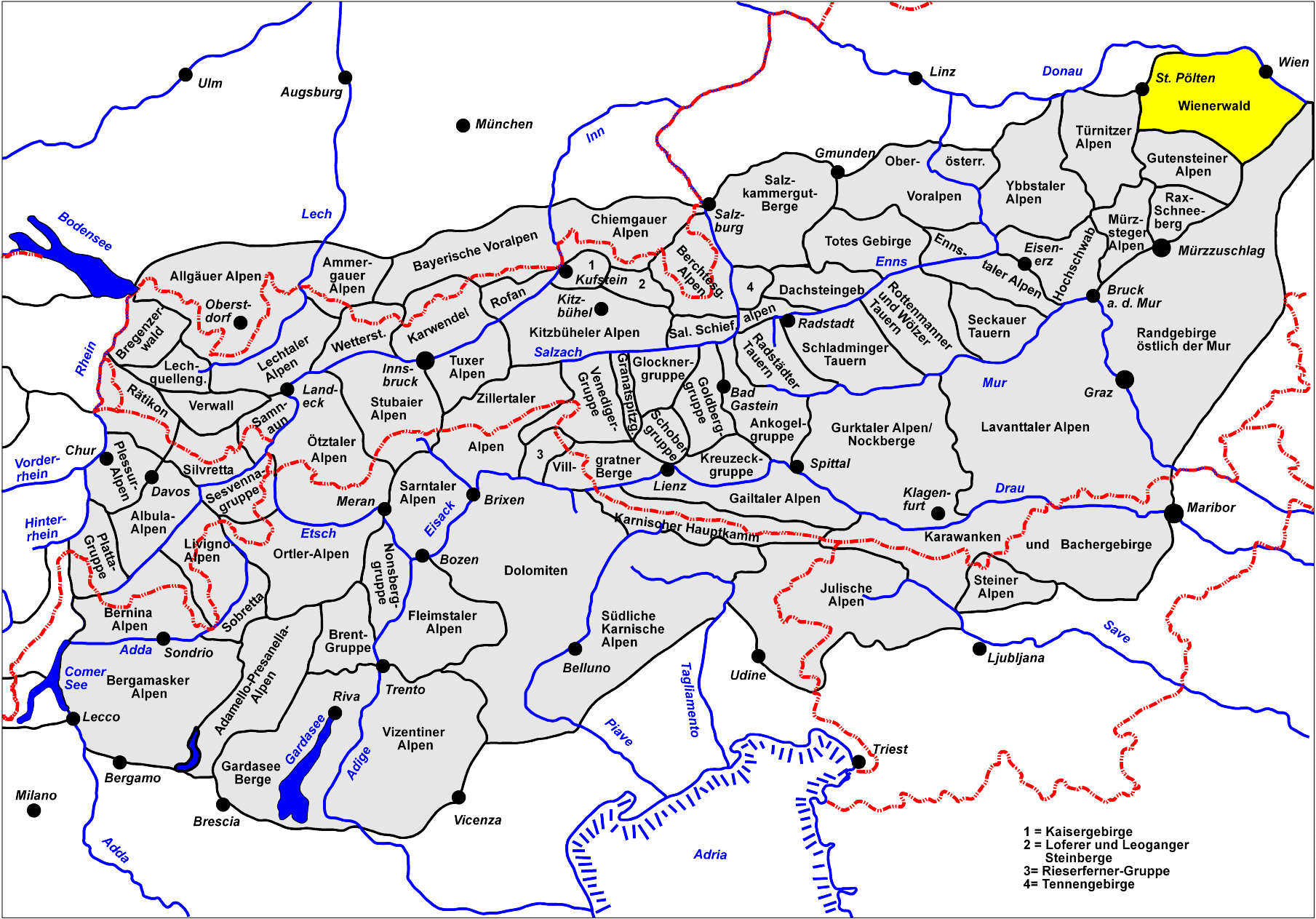
map_caption=Location of the Vienna WoodsThe Vienna Woods (German Wienerwald) is a low, wooded section of theAlps in easternLower Austria andVienna , covering over 1,000square kilometre s and including the northernmost parts of the entire Alpine chain.Location
The Vienna Woods may be defined as that group of hills bounded by the rivers
Triesting ,Gölsen , Traisen andDanube , and is a favourite outdoor destination for the densely-populated area aroundVienna [cite book |title=Wanderatlas Wienerwald |publisher=Freytag und Berndt |year=1975 |id=ISBN 3-85084-661-X] .It is located at the border between the
Mostviertel and theIndustrieviertel , two of the four quarters of Lower Austria, and reaches far into the city of Vienna.The mountain ranges of the Vienna Woods are the transition between the
Eastern Alps and the Carpathians, separated by theDanube and some tectonic lines near to Vienna. Its north is part of the Alps'sandstone zone, while its south is part of theNorthern Limestone Alps . In the east, its border is thethermal line , which forms a geological break line to theViennese Basin . Theforest in the north consists largely ofbeech es,oak s andhornbeam s, whereas in the southconifer s, mostlypine s andfir s add to the botanical mix. The "Föhrenberge" (Pine Mountains) natural park is in the latter region.and other woodland animals) and the "Schwarzenbergpark" were created on the territory of the city of Vienna during the 19th century.
Important
rivers in the Vienna Woods are the Wien, the Schwechat and theTriesting .The natural park "
Sandstein-Wienerwald " is nearPurkersdorf , some 20 km west of Vienna. There are also some naturalcaves , such as the "Dreidärrischenhöhle" ("cave of the three deaf men").History
The Vienna Woods has probably been populated since the 8th century. Under the influence of the Avars, a Slavic population settled here after the
Völkerwanderung , which may account for village names such asDöbling ,Liesing orGablitz . The Vienna Woods was a princely hunting ground, but beginning with the 16th century, it gained importance also forforestry . From 1840 onwards, the industrial development encouraged increased settlement of the area. In 1870, plans were brought forward to mostly clear the forest, but this caused widespread public resistance, in whichJosef Schöffel was one of the most important figures.In 1987, the governors of the states of
Vienna ,Lower Austria andBurgenland signed the "Vienna Woods Declaration" to protect nature in the region.External links
* [http://www.biosphaerenparks.at/biosphaerenparks/index_engl.cfm Austrian Biosphere Reserves]
* [http://geoimages.berkeley.edu/wwp306/html/ClemensPfeiffer.html 360°x180° panoramic image of the Wienerwald (Quicktime needed)]German language links
* [http://www.bpww.at/ Biosphere Park Wienerwald]
* [http://www.wienerwald.org Municipality of Wienerwald]
* [http://www.naturparke.at/index2.html?foehren/home.html Natural Park of the Föhrenberge]
* [http://www.naturparke.at/sparbach/home.html Natural Park Sparbach]
* [http://www.purkersdorf-online.at/naturpark/ Natural Park of Sandstein-Wienerwald]
* [http://www.netzwerk-wienerwald.at/ Network Wienerwald]
* [http://www.salamandra.at/wienerwald/ Wienerwald - Fauna and Flora]References
ee also
*"
Tales from the Vienna Woods
Wikimedia Foundation. 2010.