- PA postcode area
-
Coordinates: 55°45′25″N 4°51′04″W / 55.757°N 4.851°W
Paisley postcode area 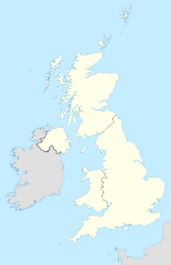
 PA
PAPostcode area PA Postcode area name Paisley Post towns 35 Postcode districts 77 Postcode sectors 105 Postcodes (live) 9,271 Postcodes (total) 12,068 Statistics as at October 2006 [1] The PA postcode area, also known as the Paisley postcode area[2], is a group of postcode districts around Appin, Bishopton, Bridge of Orchy, Bridge of Weir, Cairndow, Campbeltown, Colintraive, Dalmally, Dunoon, Erskine, Gourock, Greenock, Inveraray, Isle of Bute, Isle of Coll, Isle of Colonsay, Isle of Gigha, Isle of Iona, Isle of Islay, Isle of Jura, Isle of Mull, Isle of Tiree, Johnstone, Kilmacolm, Lochgilphead, Lochwinnoch, Oban, Paisley, Port Glasgow, Renfrew, Skelmorlie, Tarbert, Taynuilt, Tighnabruaich and Wemyss Bay in Scotland.
Contents
Coverage
The approximate coverage of the postcode districts:
Postcode district Post town Coverage Local authority area PA1 PAISLEY Paisley (Central, East and Northeast), Ralston PA2 PAISLEY Paisley (South) PA3 PAISLEY Paisley (Northwest), Linwood PA4 RENFREW Renfrew, Inchinnan PA5 JOHNSTONE Johnstone, Brookfield, Elderslie PA6 JOHNSTONE Johnstone, Houston PA7 BISHOPTON Bishopton PA8 ERSKINE Erskine PA9 JOHNSTONE Johnstone, Howwood PA10 JOHNSTONE Johnstone PA11 BRIDGE OF WEIR PA12 LOCHWINNOCH Lochwinnoch, Newton of Belltrees PA13 KILMACOLM Kilmacolm PA14 PORT GLASGOW Port Glasgow, Langbank PA15 GREENOCK Greenock PA16 GREENOCK Greenock PA17 SKELMORLIE PA18 WEMYSS BAY Wemyss Bay PA19 GOUROCK Gourock PA20 ISLE OF BUTE PA21 TIGHNABRUAICH PA22 COLINTRAIVE Colintraive, Glendaruel PA23 DUNOON PA24 CAIRNDOW PA25 CAIRNDOW PA26 CAIRNDOW PA27 CAIRNDOW PA28 CAMPBELTOWN PA29 TARBERT PA30 LOCHGILPHEAD PA31 LOCHGILPHEAD PA32 INVERARAY PA33 DALMALLY PA34 OBAN PA35 TAYNUILT PA36 BRIDGE OF ORCHY Bridge of Orchy PA37 OBAN PA38 APPIN PA41 ISLE OF GIGHA Isle of Gigha PA42 ISLE OF ISLAY PA43 ISLE OF ISLAY PA44 ISLE OF ISLAY PA45 ISLE OF ISLAY PA46 ISLE OF ISLAY PA47 ISLE OF ISLAY PA48 ISLE OF ISLAY PA49 ISLE OF ISLAY PA60 ISLE OF JURA PA61 ISLE OF COLONSAY PA62 ISLE OF MULL PA63 ISLE OF MULL PA64 ISLE OF MULL PA65 ISLE OF MULL PA66 ISLE OF MULL PA67 ISLE OF MULL PA68 ISLE OF MULL PA69 ISLE OF MULL PA70 ISLE OF MULL PA71 ISLE OF MULL PA72 ISLE OF MULL PA73 ISLE OF MULL Ulva Ferry PA74 ISLE OF MULL PA75 ISLE OF MULL PA76 ISLE OF IONA Isle of Iona PA77 ISLE OF TIREE PA78 ISLE OF COLL PA80 OBAN Morvern[3] Adjacent areas
Adjacent postcode areas PH 
 PA
PA 
FK 
KA G Clockwise from the east, the adjacent postcode areas are: FK (Falkirk), G (Glasgow), KA (Kilmarnock), PH (Perth).
See also
References
- ^ "National Statistics Postcode Directory" (PDF). Office for National Statistics Postcode Directory (November 2006). Office for National Statistics. November 2006. http://www.statistics.gov.uk/geography/downloads/NSPDVersionNotes.pdf. Retrieved 2009-05-29.
- ^ Royal Mail, Address Management Guide, (2004)
- ^ Morvern secures its own postcode from Royal Mail, BBC News
Postcode areas in the United Kingdom, Channel Islands and Isle of Man AB AL B BA BB BD BH BL BN BR BS BT BX CA CB CF CH CM CO CR CT CV CW DA DD DE DG DH DL DN DT DY E EC EH EN EX FK FY G GIR GL GU GY HA HD HG HP HR HS HU HX IG IM IP IV JE KA KT KW KY L LA LD LE LL LN LS LU M ME MK ML N NE NG NN NP NR NW OL OX PA PE PH PL PO PR RG RH RM S SA SE SG SK SL SM SN SO SP SR SS ST SW SY TA TD TF TN TQ TR TS TW UB W WA WC WD WF WN WR WS WV YO ZE
Categories:- Postcode areas covering Scotland
- Post and philately stubs

Wikimedia Foundation. 2010.