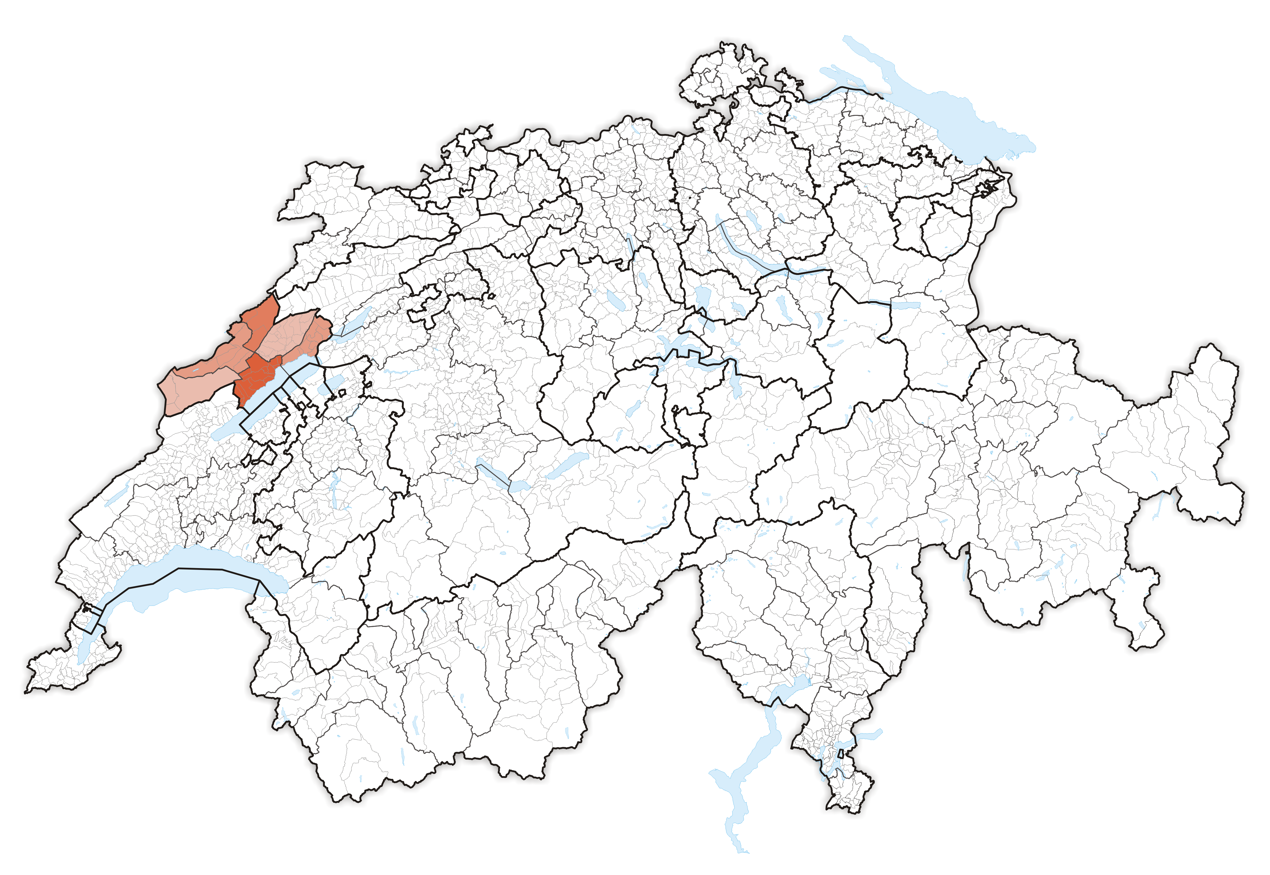
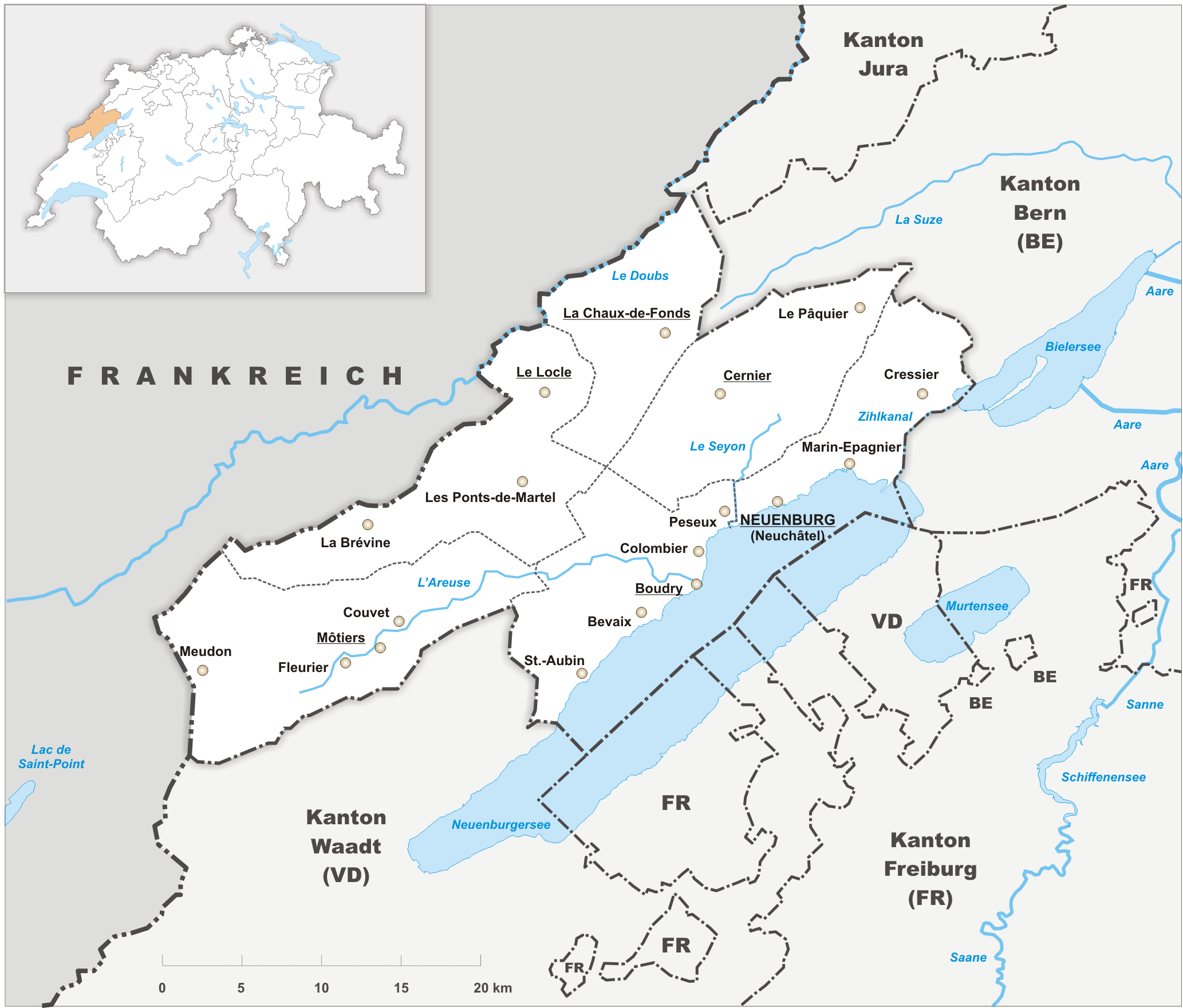
- Canton of Neuchâtel
-
République et Canton de Neuchâtel — Canton of Switzerland — 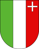
Coat of arms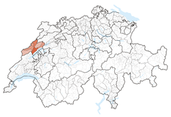
Coordinates: 46°59′N 6°47′E / 46.983°N 6.783°ECoordinates: 46°59′N 6°47′E / 46.983°N 6.783°E Capital Neuchâtel Largest City La Chaux-de-Fonds Subdivisions 53 municipalities, 6 districts Government – Executive Conseil d'Etat (5) – Legislative Grand Council (115) Area[1] – Total 802.93 km2 (310 sq mi) Population (12/2010)[2] – Total 172,021 – Density 214.2/km2 (554.9/sq mi) Highest point 1,552 m (5,092 ft) - Chasseral Lowest point 429 m (1,407 ft) - Lake Biel Joined 1815 Abbreviation NE Languages French Website NE.ch Map of Neuchâtel
County (Principality) of Neuchâtel
Grafschaft (Fürstentum) Neuenburg (de)
Comté (Principauté) de Neuchâtel (fr)State of the Holy Roman Empire (to 1806)
Associate of the Old Swiss Confed. (from 1406)← 
1034–1848  →
→
Coat of arms
Capital Neuchâtel Government Principality Historical era Middle Ages - City founded 1011 - County founded 1034 - Became associate
of Old Swiss Confed.from 1406 - Inherited by Prussia 1707 - French occupation 1806–14 - Joined Swiss Confed.
as canton1815 - Neuchâteloise
revolution
1 March 1848Neuchâtel (French: Canton de Neuchâtel, IPA: [kɑ̃tɔ̃ də nøʃɑtɛl]; German: Kanton Neuenburg) is a canton of French speaking western Switzerland. In 2007, its population was 169,782 of which 39,654 (or 23.4%) were foreigners.[3] The capital is Neuchâtel.
Contents
History
Rudolph III of Burgundy mentioned Neuchâtel in his will in 1032. The dynasty of Count Ulrich von Fenis took over the town and its territories in 1034. The dynasty prospered and by 1373 all the lands now part of the canton belonged to the count. In 1405, the cities of Bern and Neuchâtel entered a union. The lands of Neuchâtel passed to the lords of Freiburg about a century later, and then in 1504 to the French house of Orléans-Longueville (Valois-Dunois).
The French preacher Guillaume Farel brought the teachings of the Protestant Reformation to the area in 1530. When the house of Orléans-Longueville became extinct with Marie d'Orleans-Longueville's death in 1707, the Principality of Neuchâtel (German: Fürstentum Neuenburg) went to King Frederick I in Prussia of the Berlin-based Hohenzollern, who then ruled Neuchâtel in personal union. Napoléon Bonaparte deposed King Frederick William III of Prussia as prince of Neuchâtel and appointed instead his chief of staff Louis Alexandre Berthier.
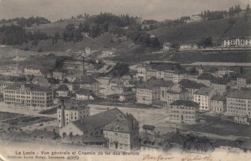
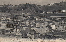 Le Locle, 1907
In 1814 the principality was restored to Frederick William III. A year later he agreed to allow the principality to join the Swiss Confederation, then not yet an integrated federation, but a confederacy, as a full member. Thus Neuchâtel became the first and only monarchy to join the otherwise entirely republican Swiss cantons. This situation changed in 1848 when a peaceful revolution took place and established a republic, in the same year that the modern Swiss Confederation was transformed into a federation. King Frederick William IV of Prussia did not give in immediately and several attempts at counter-revolution took place, culminating in the Neuchâtel Crisis of 1856–57. In 1857, Frederick William renounced his claims on the area.
Geography
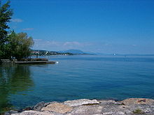
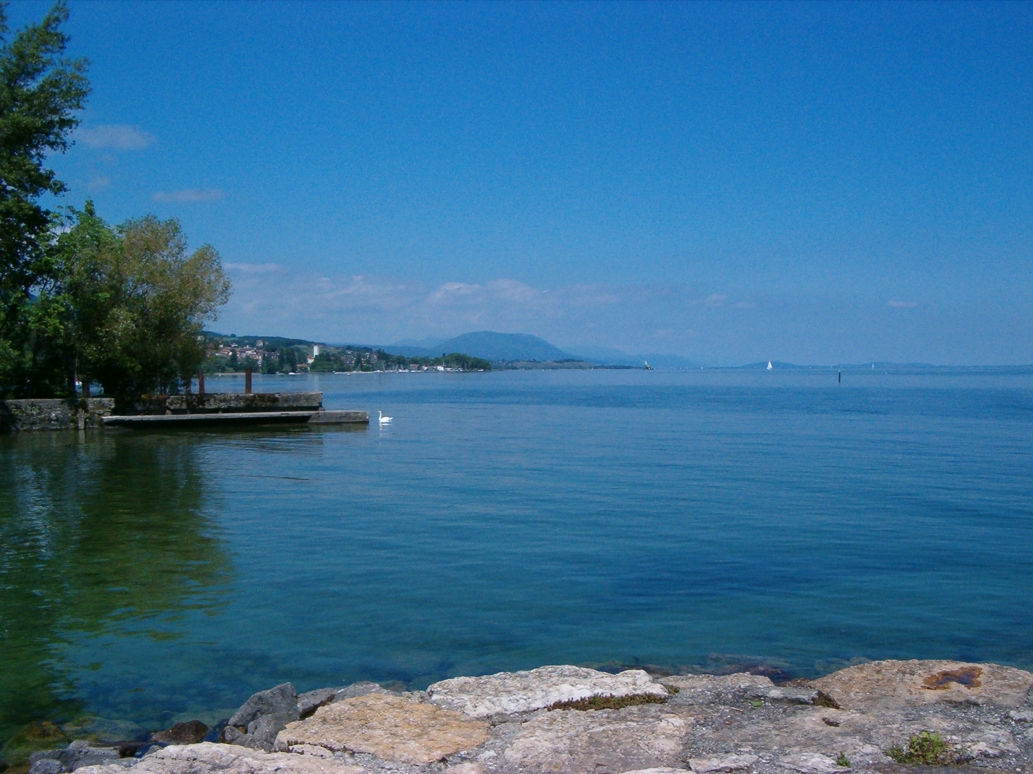
The canton of Neuchâtel is located in Romandy, the western part of Switzerland. To its northeast it borders the canton of Bern, to the northwest France. Lake Neuchâtel lies southeast of the canton, while the canton of Vaud is southwest of the canton of Neuchâtel. The canton lies in the central area of the Jura Mountains. Lake Neuchâtel drains the lands in the south, whilst the River Doubs drains the northern areas.
The canton is commonly divided into three regions. The viticultural region is located along the lake. Its name derives from the many vineyards found there. The region called Les Vallées lies further north. The two largest valleys of the canton of Neuchâtel lie in this region: the Ruz Valley and the Val de Travers. Both valleys lie at about 700 m (2,297 ft). The highest region of the canton, however, is the Neuchâtelois Mountains at 900 m (2,953 ft) to 1,065 m (3,494 ft). This region is made up of a long valley home to La Chaux-de-Fonds, Le Locle and La Brévine.
Government
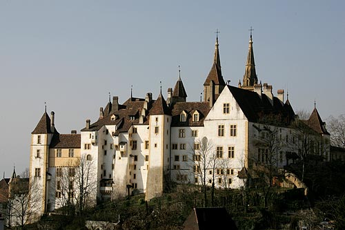
 Château de Neuchâtel, now seat of the cantonal government
Neuchâtel was one of the first cantons in Switzerland to grant women the vote (1959) and also to grant the vote to foreigners holding a residence permit and who have been domiciled in the canton for at least 5 years (2002), as well as to lower the voting age to 18.
The legislature, the Grand Council of Neuchâtel, has 115 seats distributed in proportion to the population of the 6 districts that make up the electoral constituencies: Neuchâtel (35 seats), Boudry, (25) Val-de-Travers (8), Val-de-Ruz (10), Le Locle (10), La Chaux-de-Fonds (27). The State Council (cantonal government), 5 “ministers” who assume the annual presidency in turn and manage the departments of justice, health and safety; finance and social welfare; public economy; regional management; education and culture. The cantonal authorities, which have their seat in the castle (the Château de Neuchâtel), are elected every four years by universal suffrage.
The people also elect their representatives to the federal parliament every four years: five of the 200 members of the National Council (lower chamber) and 2 of the 46 members of the Council of States (upper chamber).
Political subdivisions
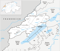
Districts
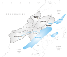 Districts of Canton Neuchâtel
The Canton is divided into 6 districts:
- Boudry with capital Boudry
- La Chaux-de-Fonds with capital La Chaux-de-Fonds
- Le Locle with capital Le Locle
- Neuchâtel with capital Neuchâtel
- Val-de-Ruz with capital Cernier
- Val-de-Travers with capital Val-de-Travers
Municipalities
Main article: Municipalities of the canton of NeuchâtelThere are 53 municipalities in the canton (As of 2009[update]).[4]
Demographics
 La Chaux-de-Fonds, most populous city in the canton
The population is almost entirely French-speaking. The canton has historically been strongly Protestant, but in recent decades it has received an influx of Roman Catholic arrivals. In 2000, its population was closely split between Protestants (38%) and Roman Catholics (31%).[5]
The 172,021 inhabitants (as of 2010[update])[2] are fairly evenly distributed with many small towns and villages lining the shore of the Lake of Neuchâtel The average population density is 209 people per km2 (542 sq mi). Neuchâtel (2010 population: 32,973) is the canton's capital while La Chaux-de-Fonds (2010 population: 37,523) is the canton's largest settlement. Some 38,000 of the inhabitants, or a little less than a quarter of the population, are of foreign extraction.
Economy
The canton is well-known for its wines, which are grown along the Lake Neuchâtel, and for its absinthe. The Val-de-Travers is famous as the birthplace of absinthe, which has now been re-legalized both in Switzerland and globally. There are dairy farming and cattle breeding in the valleys, but it is for the breeding of horses that Neuchâtel has a fine reputation. Watchmaking, see "Watch Valley", is well established in the canton, with fine mechanics and microchip production being established more recently. Higher educational institutions include Haute école de gestion de Neuchâtel and the University of Neuchâtel.
External links
- Official website
- Official statistics
- Neuchâtel and surroundings "Watch Valley"
- Portal Neuch.ch
- Village of Valangin
References
- ^ Arealstatistik Standard - Kantonsdaten nach 4 Hauptbereichen
- ^ a b Canton of Neuchatel Statistics, République et canton de Neuchâtel - Recensement annuel de la population (German) accessed 13 October 2011
- ^ Federal Department of Statistics (2008). "Ständige Wohnbevölkerung nach Staatsangehörigkeit, Geschlecht und Kantonen" (Microsoft Excel). http://www.bfs.admin.ch/bfs/portal/de/index/themen/01/02/blank/key/raeumliche_verteilung/kantone__gemeinden.html. Retrieved November 5, 2008.
- ^ "Liste officielle des communes de la Suisse - 01.01.2008". Office fédéral de la statistique. http://www.bfs.admin.ch/bfs/portal/fr/index/infothek/nomenklaturen/blank/blank/gem_liste/03.Document.90142.xls. Retrieved 15 décembre 2008.
- ^ Federal Department of Statistics (2004). "Wohnbevölkerung nach Religion" (Interactive Map). http://www.bfs.admin.ch/bfs/portal/de/index/themen/01/05/blank/key/religionen.html. Retrieved 2009-01-15.
Three Cantons · Eight Cantons · Thirteen Cantons · coats of arms historical cantons: Unterwalden ·
  Basel ·
  Appenzell · Baden · Bellinzona · Fricktal · Léman · Linth · Lugano · Oberland · Raetia · Säntis · Waldstätten
Territories and provinces of Prussia (1525–1947) Before 1701 Duchy of Prussia · Margraviate of Brandenburg · Cleves / Mark / Ravensberg (1614) · Farther Pomerania / Minden / Halberstadt (1648) · Lauenburg–Bütow / Draheim (1657) · Magdeburg (1680) · Colonies (Groß Friedrichsburg · Arguin)After 1701 Neuchâtel (1707) · Guelders (1713) · Minden-Ravensberg (1719) · Western Pomerania (1720, 1815) · Silesia / Glatz (1742) · East Frisia (1744) · East / West Prussia (1772-73) · South Prussia (1793) · New East Prussia / New Silesia (1795)Post-Congress of
Vienna (1814–15)Brandenburg · Pomerania · Grand Duchy of Posen1 · Saxony · Silesia · Westphalia · Rhine Province2 (1822) · Province of Prussia (1824–78) · Hohenzollern (1850) · Schleswig-Holstein / Hanover / Hesse-Nassau (1866–68)Territorial reforms
after 1918Lower / Upper Silesia (1919) · Greater Berlin (1920) · Posen-West Prussia (1922) ·
Halle-Merseburg / Magdeburg / Kurhessen / Nassau (1944)Categories:- Former principalities
- Former countries in Europe
- States of the Holy Roman Empire
- States and territories established in 1034
- States and territories disestablished in 1848
- Cantons of Switzerland
- Canton of Neuchâtel
- Arpitany
- Subdivisions of Prussia


Wikimedia Foundation. 2010.